Forum index >> Initiatives >>
Tree mapping event in July Malaysia
Page : 1ReplyNew topic

A small mapping event has been planned for the 19 of July.
Meeting at 4:30 at the University of Malaya at the Library bus stop (opposite the Faculty of Arts)
The proposed area to be mapped is:
http://pericopsis.org/trees/engoutnam.php?polygon=meeting
Different techniques (GPS, reporting on printed pictures) will be tested. Field data collection will be followed by a data entry in a place with wifi and food
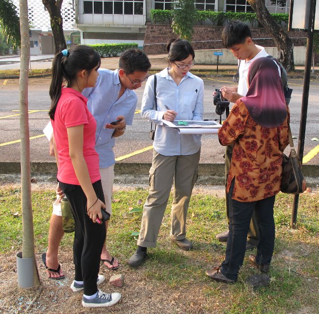
The Team at work. Identified trees were noted on a print of a Google map
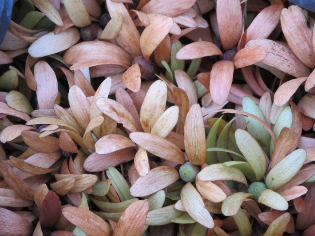
Dryobalanops aromatica an endangered local species. Who's gonna to germinate all of them?

Entering data between the main course and the dessert
Meeting at 4:30 at the University of Malaya at the Library bus stop (opposite the Faculty of Arts)
The proposed area to be mapped is:
http://pericopsis.org/trees/engoutnam.php?polygon=meeting
Different techniques (GPS, reporting on printed pictures) will be tested. Field data collection will be followed by a data entry in a place with wifi and food
The Team at work. Identified trees were noted on a print of a Google map
Dryobalanops aromatica an endangered local species. Who's gonna to germinate all of them?
Entering data between the main course and the dessert

any incoming mapping activities for August?
any incoming mapping activities for August?
I am overseas with Khadijah during the month of August. Therefore we didn’t plan to participate to field activities in Malaysia during that month (We will map some trees in France).
However do not hesitate to propose yourself a mapping activity of an area of your choice in a new topic. If it is in September and on a week-end we will definitely join you. If not, you may always put tree pictures you may not be able to identify on the Forum.
I noticed that your current polygon http://pericopsis.org/trees/engoutnam.php?polygon=tinkerleong is quite attractive to map because the tree are visible and nicely individualized. It is also near to our place, we stay in Seri Kembangan.
There is also a patch of forest left along the highway at the west of your current polygon. Is this forest accessible from your place? It would be interesting to see if there are remnants of local and endangered tree species. If difficult to map (trees in groups are difficult to differentiate on google map), such patch of forests gains to be explored for its potential to support ex-situ conservation.

Hi Leong,
I would have time on Saturday evening (26 July, 2014) but Jean is currently busy with the thesis of his student. If you agree with the idea, please let me know what time is suitable for you. According to the size and land coverage, two persons should be good enough for mapping the tree.
The question is that, how we gonna do it? Using tablet, computer with broadband, or manually? Last week (19 July 2014), two groups of us mapped the trees nearby UM library. First, we mapped the tree on printed google map, which later the data were keyed into pericopsis.org during the diner time. According to our experience, this method is the easiest way.
As we will be away soon for one month (28 July - 25 August 2014), I would be to do mapping this week.
Cheers
Khadijah
Dr. Khadijah
My apologies for belated reply.
I think munually method with phone taken suits me (phone camera with GPS enabled feature)
Perhaps we can make another arrangement on September-October.
Dr. Jean,
The patch forest is a hiking area called "Serdang Hill", some of area is rubber tree.
here is the trail recorded:
http://en.wikiloc.com/wikiloc/spatialArtifacts.do?event=setCurrentSpatialArtifact&id=3853659
somehow there is hidden polluted area due to fish farming:
http://en.wikiloc.com/wikiloc/spatialArtifacts.do?event=setCurrentSpatialArtifact&id=3901006
To summarize the area, there is 2 destination known so far:
1. path(s) to hill top
2. path to Taman Universiti
Page : 1ReplyNew topic